Novels of the Malazan Empire:
Based on the original map by Ian Cameron Esslemont & Neil Gower
Overview
From malazan.fandom.com
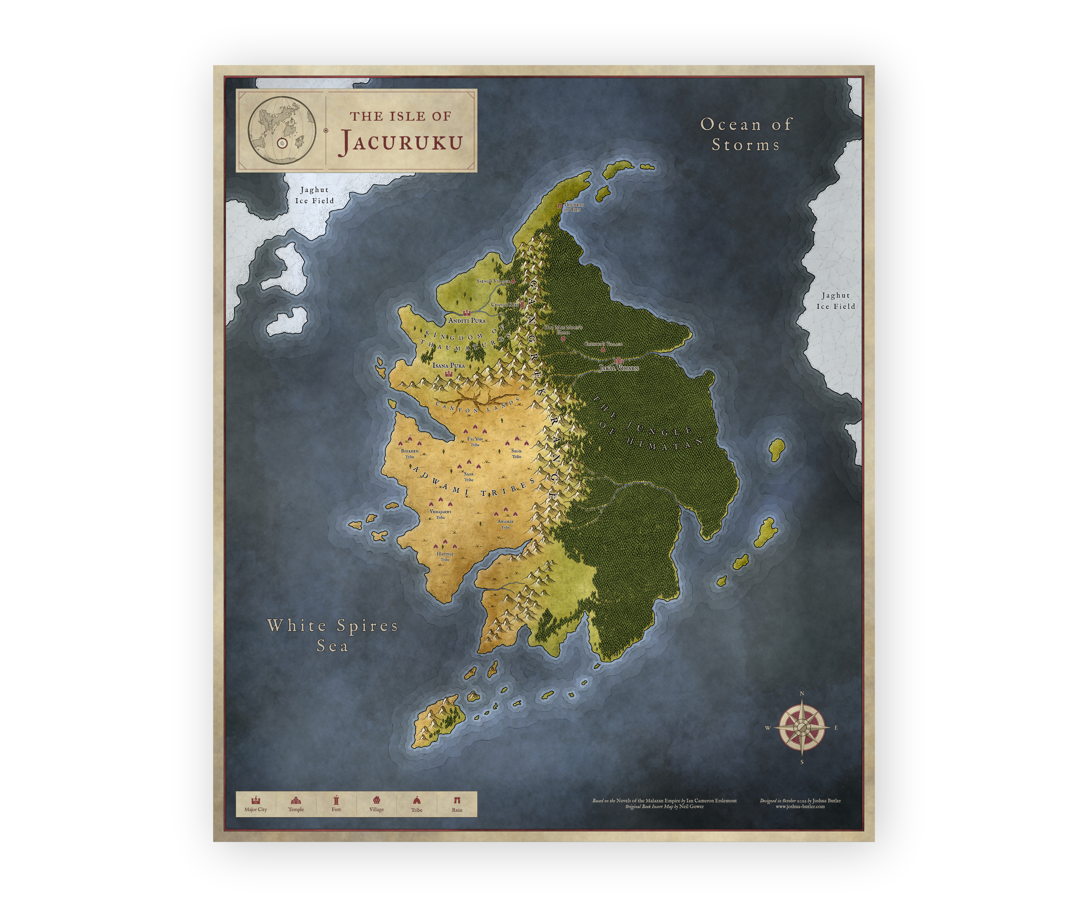
The continent of Jacuruku was a small island-continent located south-west of Stratem and Korel, south of Quon Tali and Seven Cities and east of Lether. It was divided in two by the Gangrek Range, with deserts lying to the west and thick jungles to the east.
Areas of Note:
- Kingdom of the Thaumaturgs, a mageocracy dominating north-western Jacuruku.
- Desert of the Adwami Tribes, located south of the kingdom and Canyon Lands in western Jacuruku.
- The Dolmens of Tien is the site of a previous Chaining of the Crippled God, located at the northernmost tip of the continent.
- The jungle of Himatan is an immense jungle dominating the eastern half of the continent. Ruled by Ardata.
- The Gangrek Range is a substantial mountain range dividing the continent into two roughly equal halves.
Map of Isle of Jacuruku

