Atlanta Beltline Wayfinding:
Based on the original proposal to add more transit in Atlanta’s MARTA with a tram system run by the Atlanta Beltline
Overview
The Atlanta Beltline is a loop of former railroad tracks surrounding central Atlanta that will be the basis of a new tram system that will expand the coverage of the current MARTA system. My challenge was to develop a wayfinding program that integrates the two transit systems and to provide Atlantans with the information they need to take advantage of the new program.
The Beltline tram system and its connected parks were proposed by Ryan Gravel for his graduate thesis.
This was a personal project created for my graduate thesis at Georgia State University. I created all aspects of this project – maps, street furniture, 3D models, wayfinding plans, and branding.
References
Beltline Symbol

Logo for the unified Atlanta transportation network.
MARTA / Beltline Map (In Context)
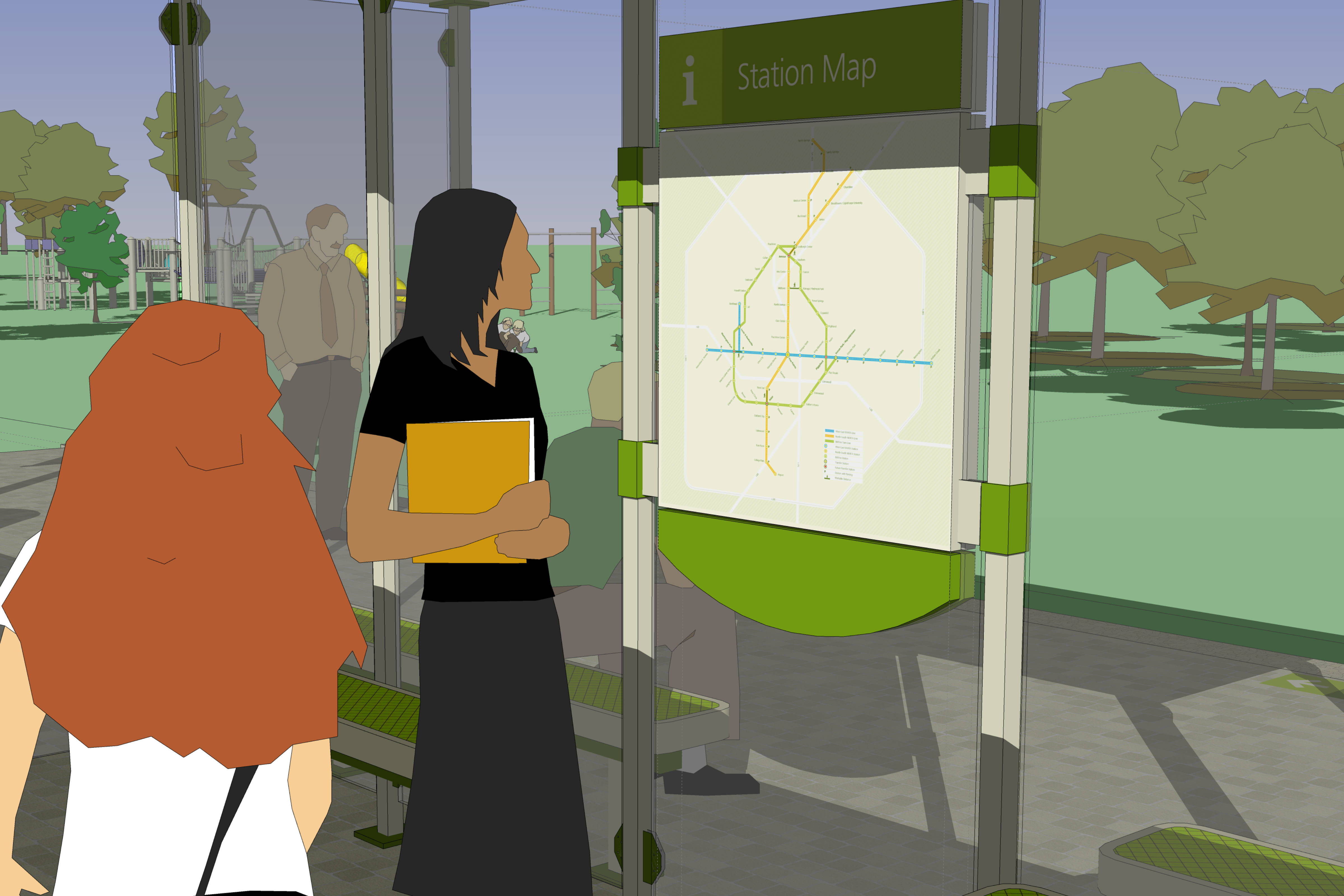
Many public transit systems around the world provide a train line that loops around the inner-city that connects the other incoming lines. This helps commuters by providing a way to travel around the city without having to go all the way to a central terminus and then transfer. This reduces travel times by creating a short cut between lines, and the Beltline would provide this opportunity to the MARTA. When I created the station map, it was important to represent the utility of the the new “circle” line.
MARTA / Beltline Map (Isolated)
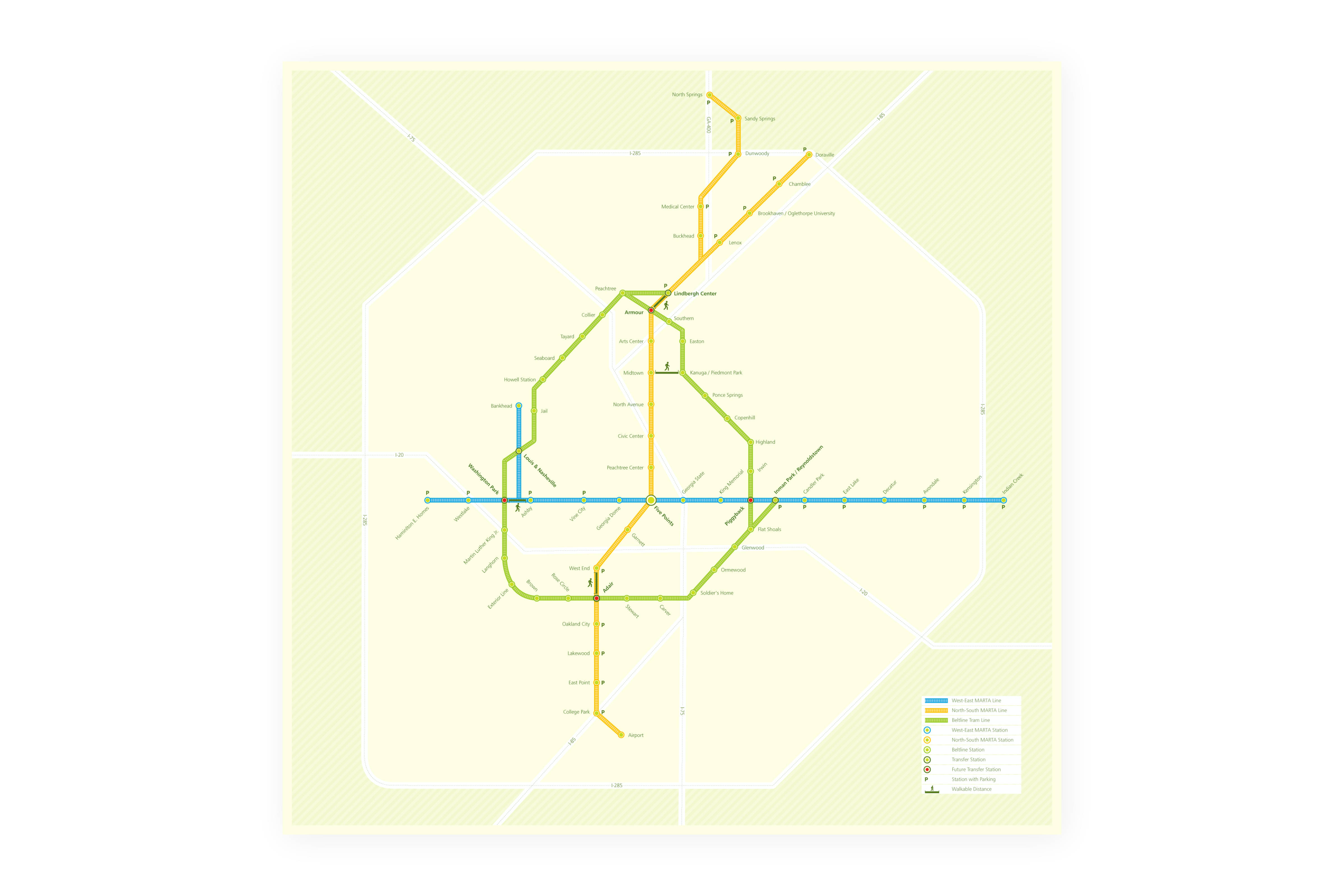
A key device for connecting the Beltline to the MARTA was to create unified map that shows how both transit systems can work seamlessly. To maintain familiarity with MARTA customers, the shape of the original blue and orange routes remained similar, while the Beltline loop was added. The proportional size of central Atlanta was increased to give greater emphasis on inner city transit.
“30 Minute” Walking Map Kiosk (In Context)
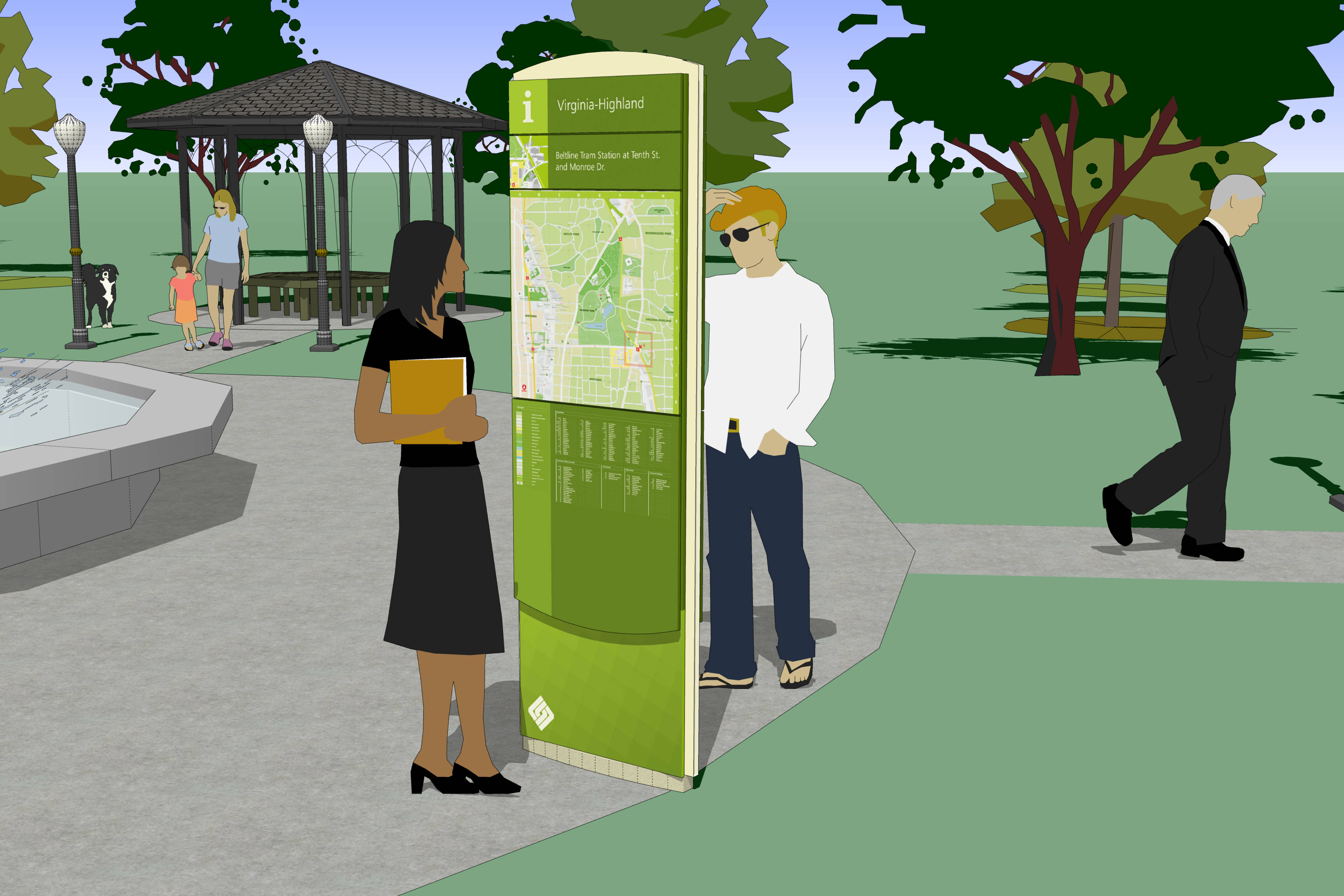
A primary goal of the wayfinding program was to educate residents on the walkability of Atlanta. A blueprint for a series of maps was created to showcase the walkable areas of Atlanta. The area on the maps represents a distance that would take an average person 30 minutes to walk.
The maps were designed to be placed on a kiosk that would be distributed around central Atlanta. On the kiosk, the user would find a legend with all the streets and landmarks in the local vicinity.
“30 Minute” Walking Map Kiosk (Isolated)
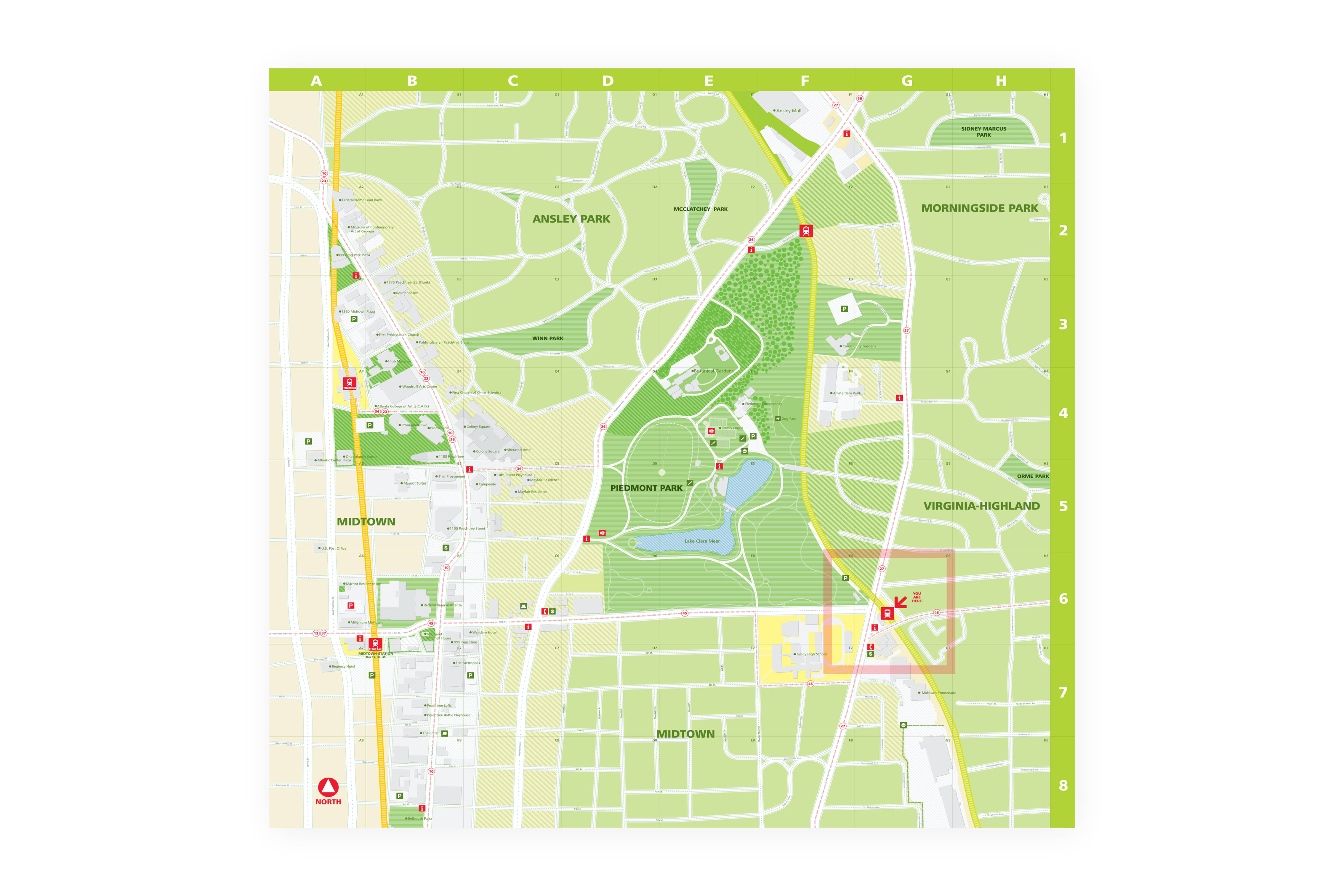
As an aid for understanding the walkability of Atlanta, the maps were illustrated in such a way as to give a visual understanding of how the local area is designed. Atlanta is a conventional American city where there can be a distinct separation between urban and residential areas. Each area type on the map has a distinct visual appearance, which allows users to dramatically improve their commuting plans. For example, the user should find it easier to stay on major streets in more urban areas, rather than cutting through residential neighborhoods.
Map Kiosk Detail
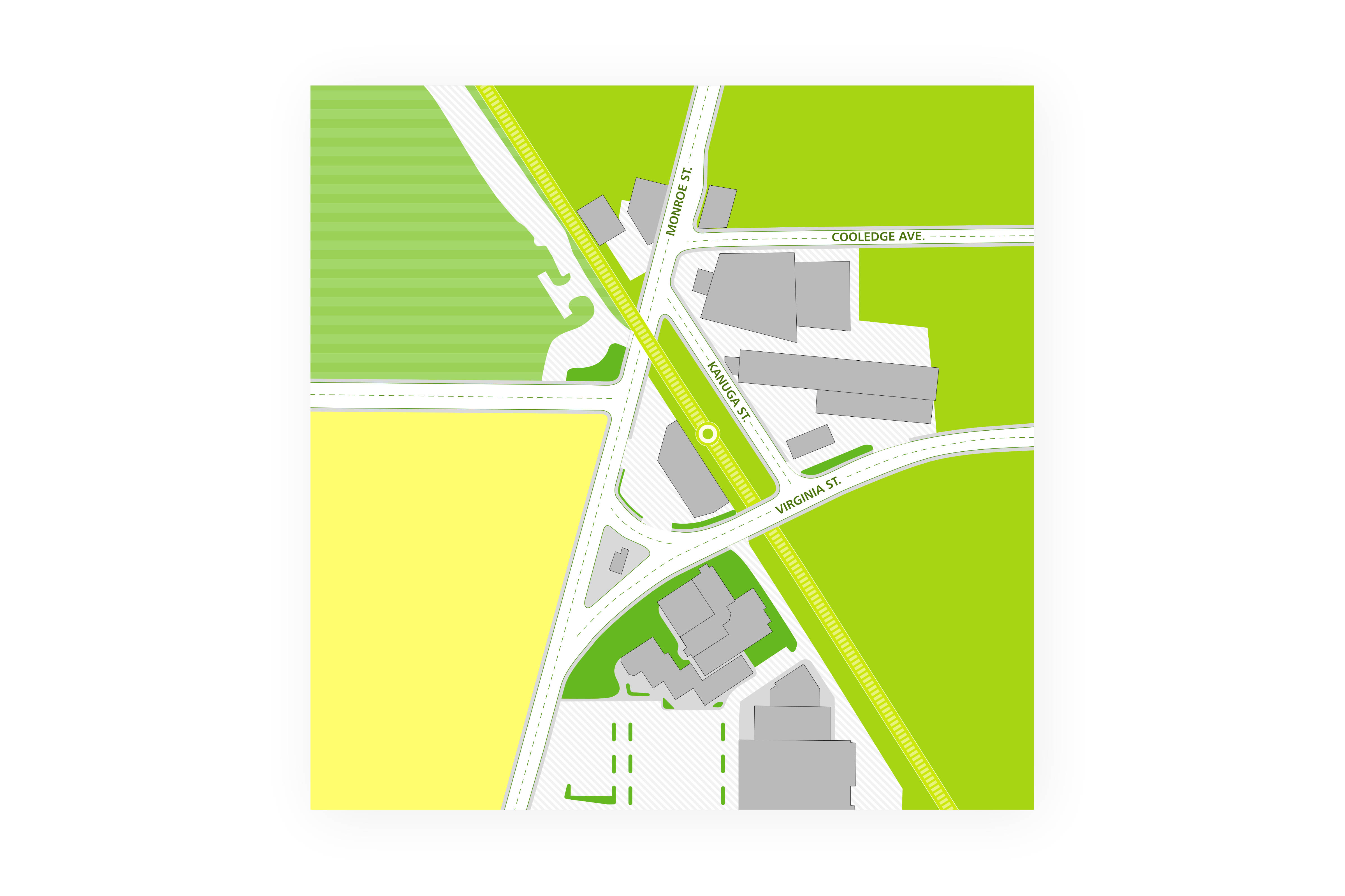
The detailed map on the kiosk shows a zoomed in view of immediate area of the map.
Bus Route Post (In Context)
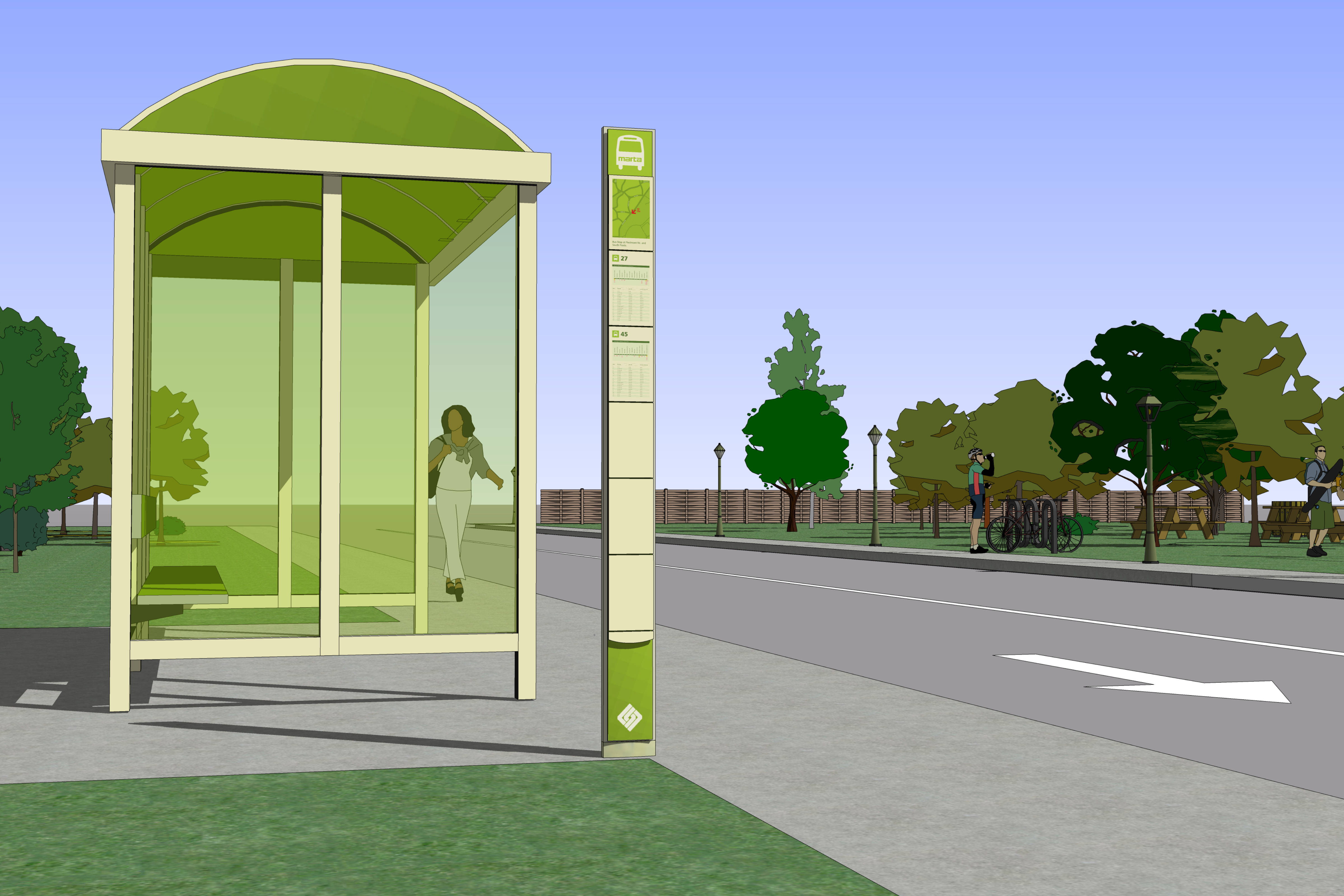
To further enhance commuting in Atlanta, it would be useful to also show users how the MARTA bus system connects to the Beltline and MARTA train lines. At the time, the bus system only used a simple post with a transit number to indicate a bus stop.
It would be beneficial to users to know where the bus is going and how frequently it arrives at the stop. I designed a new bus stop post that shows the bus routes, transit connections along the routes, and bus arrival times.
Bus Route Post (Detail)
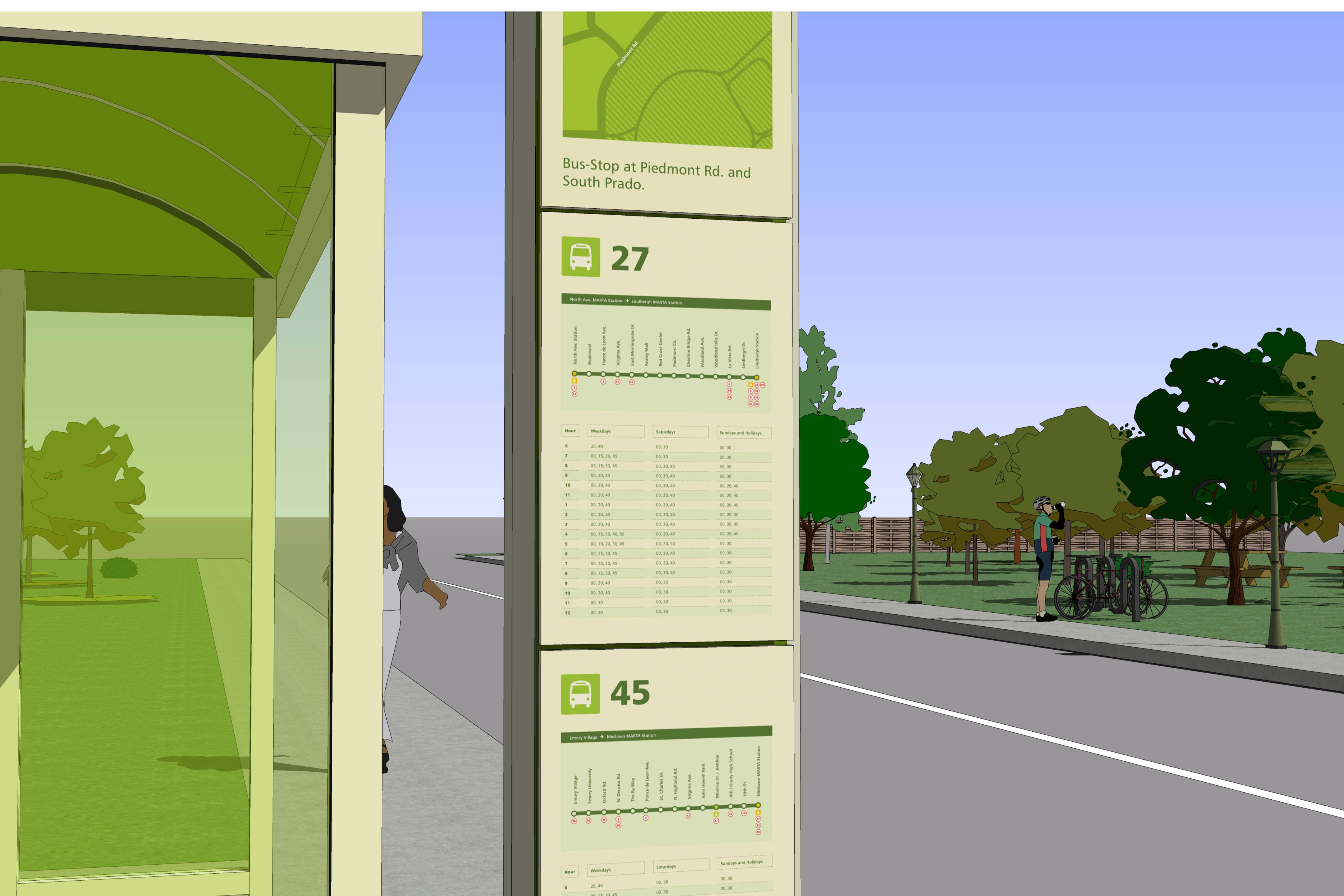
Bus times and location detail
Pedestrian Directional Post
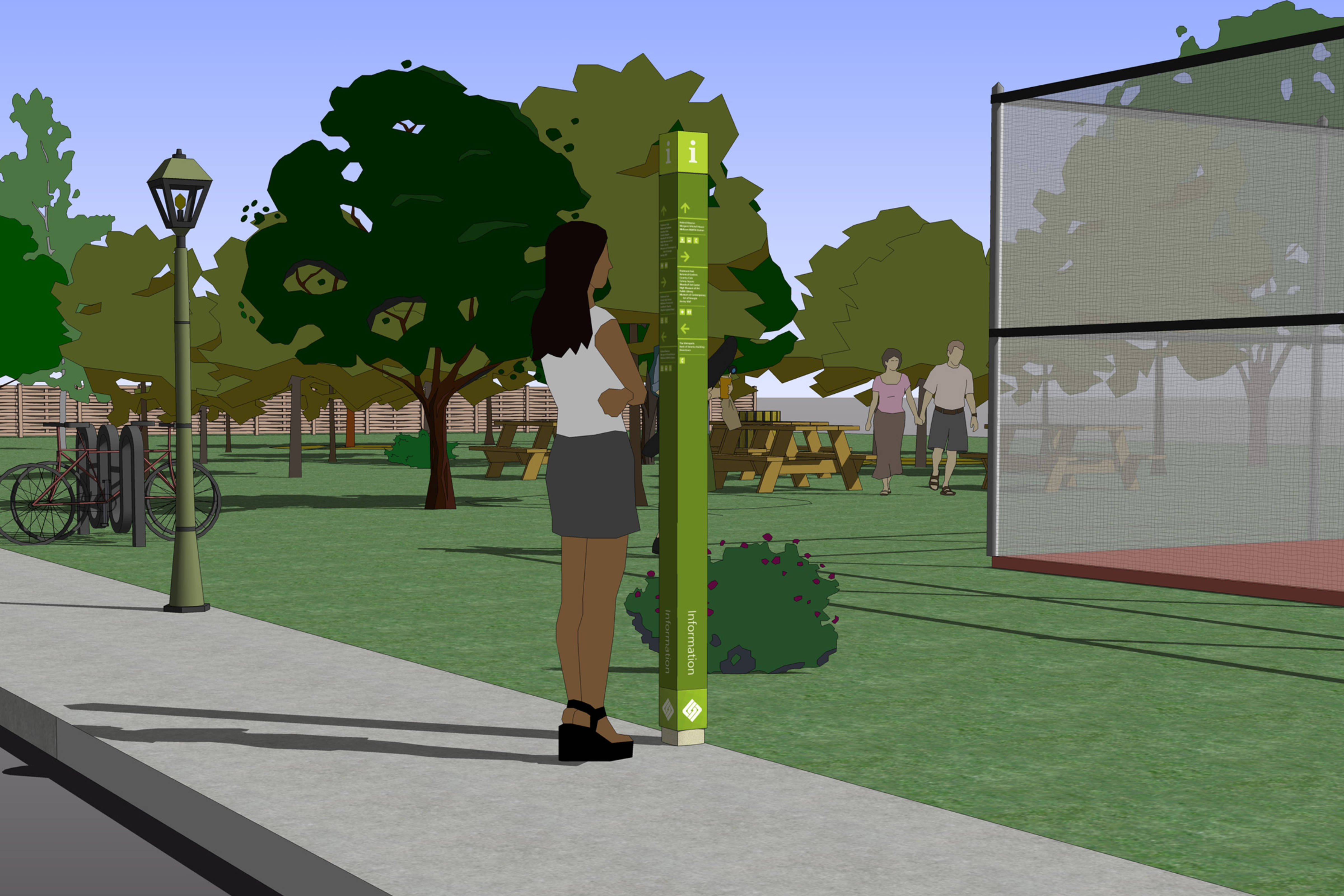
One last additional sign post was created to help users find their way. A series of tall directional posts were used to provide wayfinding assistance to areas where the map kiosks were unlikely to be placed.
These slim posts were meant to fill in the gaps between 30-Minute Map kiosks. The posts simply directed users to popular local destinations, but didn’t provide any other type of local orientation content.
